
Walking to Old Sarum
About 45 minutes on foot from Salisbury station to Old Sarum castle, with a climb at the end.
From
Salisbury station
How do you want to go?
SAVE UP TO 78%
Shared shuttle
Share with others going to Old Sarum.
from
£3.63
each
Private shuttle
Whole vehicle, up to 8 people.

Premier Taxis Salisbury
£16.75
per vehicle
About 45 minutes on foot from Salisbury station to Old Sarum castle, with a climb at the end.
Your shuttle is a licensed private hire car run by Premier Taxis Salisbury.
Station to castle gate, step by step
From Salisbury station it is about 3.3 kilometres (2 miles) on foot, about 45 minutes at a steady pace, with a climb at the end. From the Market Place it is about 2.9 kilometres, about 40 minutes. The usual route follows Castle Road north.
1
Leave by the main entrance Come out of Salisbury station onto South Western Road.
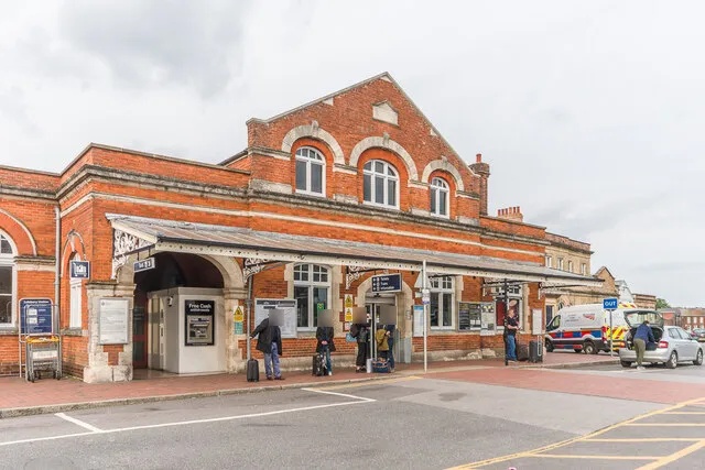
Photo: Ian Capper, CC BY-SA 2.0, via Geograph
2
Fisherton Street Head from the station towards the city centre.

Photo: Ian Capper, CC BY-SA 2.0, via Geograph
3
Spire View and St Paul’s Road Cut across to the bottom of Castle Road.
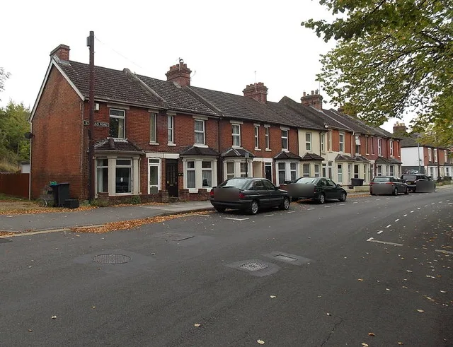
Photo: Jaggery, CC BY-SA 2.0, via Geograph
4
Castle Road (the A345) Follow it north and uphill. The pavement runs alongside the road; traffic is 30 mph near the city and 40 mph nearer Old Sarum.
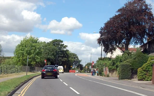
Photo: Julian P Guffogg, CC BY-SA 2.0, via Geograph
5
The English Heritage driveway Turn up the drive. It is narrow and shared with cars, and has two sharp bends.
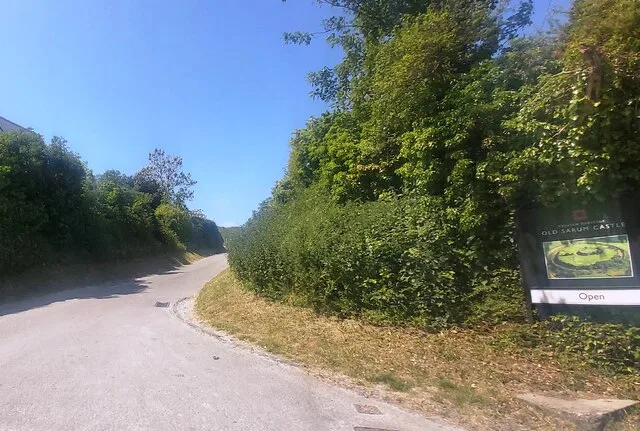
Photo: Anthony Parkes, CC BY-SA 2.0, via Geograph
6
Over the wooden bridge The ticket office is across the wooden bridge, on the right.
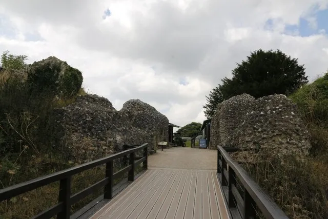
Photo: Bill Nicholls, CC BY-SA 2.0, via Geograph
Download the walking route (GPX file)
For a phone map or GPS app. Drawn from OpenStreetMap, not recorded on foot, so check the way as you go. Map data © OpenStreetMap contributors.
A quieter route by the river
The village of Stratford sub Castle, below Old Sarum on the west side, publishes its own walks, including a route up to Old Sarum (a steep climb) and an easier one. It lies in a flood plain, so check its walks page for path conditions first.
Castle Hill Country Park, next to Old Sarum, has views of the cathedral. Its paths are a mix of surfaced and unsurfaced, with some steep parts.
Before you set off
Shoes
English Heritage says the chalk paths at Old Sarum get slippery in winter and the grass is bumpy.
Daylight
We couldn’t confirm that the whole road route is lit, so plan to walk it in daylight.
Food and drink
There is no café at Old Sarum, only a vending machine. Picnics are welcome.
Time on site
Allow about an hour to look round, says English Heritage.
Walk one way, ride the other
Plenty of people walk downhill and take a shuttle up, or the other way round. Sharing costs from £3.63 each.
Questions
About 45 minutes from the station and 40 from the Market Place, at a steady pace. The hill makes it slower for many people.
It is a road walk with a climb at the end. Most fit walkers manage it fine.
OpenStreetMap shows a pavement along Castle Road. The last part is the narrow English Heritage driveway, shared with cars.
Yes, about 3.5 kilometres, about 45 minutes, via Castle Road, Nelson Road and the High Street.
Check before you go
Times, prices and opening hours change, so we link to the official pages rather than copy them.
Stratford sub Castle village walks
Castle Hill Country Park, Land Trust
Traveline South West journey planner
Old Sarum access information
Related pages
Facts last checked: 21 October 2026.